 |
|
ILLUSTRATION JAMES DORRIAN 2014 |
|
All material contained in this site is subject to copyright and must not be reproduced in any format without the consent of the relevant copyright holder
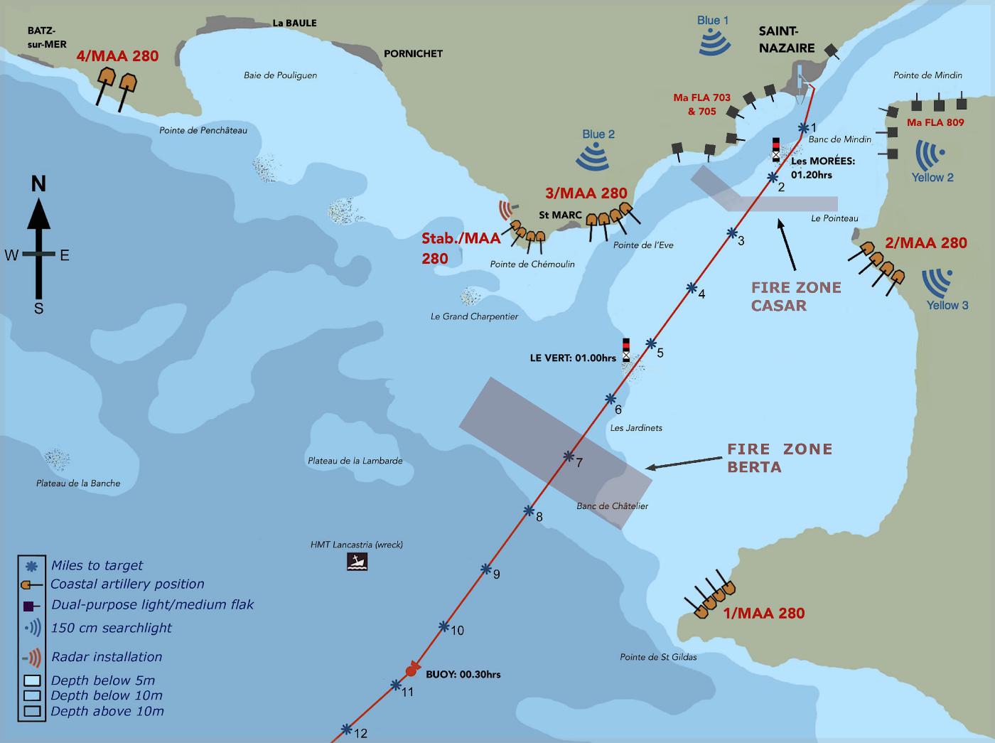
As is evident from the underwater topography illustrated above, the Loire estuary belies its apparent open accessibility by restricting larger vessels to the narrow, winding deep-water channel which hugs the northern shore. With much of the remaining surface area hiding dangerous and shifting shoals, the German defenders, as had the French before them, chose to place their heavier batteries to cover this single channel, never expecting that an invading force would actually choose to risk an approach across waters considered barely safe for fishing boats. It was in accepting the risk that Campbeltown might ground (which she did twice) and become a sitting duck, that the success of the Raid lay, the skilful navigation of the fleet later drawing praise from even the hugely-experienced Loire pilots. As well as housing the most powerful gun batteries, the northern shore was also home to a radar station in the area of the Pointe de Chémoulin, close to Dieckmann's HQ. His opposite number Mecke, had his HQ in the Château de St. Marc.
The arrangement of the defensive batteries assumed that an enemy force would be engaged early, by Dieckmann's medium and heavy guns, leaving Mecke's lighter cannon to guard the estuary narrows. It was for this reason that none of the new and powerful 170mm emplacements spread atop the cliffs of the Pointe de l'Eve, was aligned to allow for the engagement of targets in the area of Les Morées and the Pointe de Mindin. Had this not been the case, the outcome for the raiders might have been altogether different.....